طبیعت کانادامسافرت

شگفتی‌های طبیعی کانادا که نفس هر بازدیدکننده‌ای را در سینه حبس می‌کند

کانادا در این جهان کشوریست که به خاطر مناظر زیبا و محصور کننده‌اش شناخته شده است. تقریباً 90 درصد کشور خالی از سکنه است و همین خود به معنی عجایب طبیعیِ بکر و دست نخورده بیشمار است. در حقیقت، زیبایی را می‌شود در هر گوشه‌ای از کانادا دید و در زیر به تعدادی از آنها اشاره می‌شود.

  • آبشار‌های نیاگارا، انتاریو

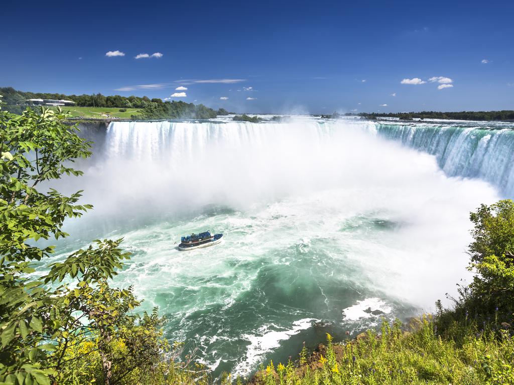
در حقیقت، دو عدد از سه آبشاری که مشهورترین عجایب طبیعی کانادا را شکل می‌دهد، در سمت آمریکایی مرز ایالات متحده و کانادا وجود دارد. اما خیلی پیش‌تر از به وجود‌ آمدن مرز‌های بین‌المللی، این آبشار به وجود آمده از زمین لرزه، چیزی حدود 10 هزار سال پیش از دلِ کو‌های یخی عظیم و گسلی عظیم در بستر رودخانه پدیدار شد. امروزه این آبشار سه گانه یک شکل نعل اسبی را تشکیل می‌دهد و هر ثانیه 3160 تُن آب را روانۀ تنگۀ نیاگارا می‌کند. بهترین منظره را می‌توان از طرف کانادایی مشاهده کرد.

<span>1/20</span><h2>Niagara Falls, Ontario</h2><p> Ironically, two of the three waterfalls that make up Canada’s best-known natural wonder are on the US side of the border. But long before international boundaries, <a href="https://www.niagarafallstourism.com/" rel="nofollow" target="_blank">this seismic water feature </a>was crafted out of melting glaciers and a giant fault in the riverbed some 10,000 years ago. Today this trio forms a massive U-shape that pours 3160 tons of water into the Niagara Gorge every second — best seen from the Canadian side.</p>

  • دریاچۀ موراین، آلبرتا

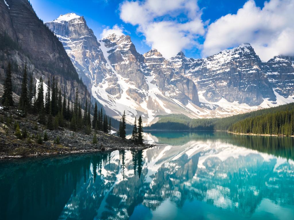
در حالی که دریاچۀ لویس گردشگران زیادی را به خود جلب می‌کند، کمی به سمت جنوب‌تر دریاچۀ موراینِ کم ازدحام‌تر و (و بنا به گفتۀ بسیاری زیباتر) قرار دارد. در میان فراز و نشیب‌های درۀ Ten Peaks، این دریاچۀ زمردی، الماسی است در دلِ کو‌ه‌های سر به فلک کشیده. رنگ آن را «پودر سنگی» ایجاد می‌کند که توسط اسطکاک سنگ‌ها در زیر حرکت توده‌های یخی در همان نزدیکی‌ها به وجود می‌آیند. زمانی که این پودر بسیار نرم به دریاچه می‌رشد، باعث انعکاس نور خورشید می‌شود که رنگ آبیِ سورئالی را به وجود می‌آورد.

<span>2/20</span><h2>Moraine Lake, Alberta</h2><p> While Lake Louise has had its fair share of limelight, just south is less crowded (and arguably more beautiful) <a href="http://banffandbeyond.com/" target="_blank">Moraine Lake</a>. Set in the rugged Valley of Ten Peaks, this vivid turquoise lake is the centrepiece amid jagged mountains, waterfalls and rock piles. Its colour is the result of “rock flour”, caused by rocks grinding underneath ice as the nearby glacier moves. When the fine flour reaches the lake, it reflects sunlight to create an unreal shade of blue.</p>

  • پرتگاه بوفالو، آلبرتا

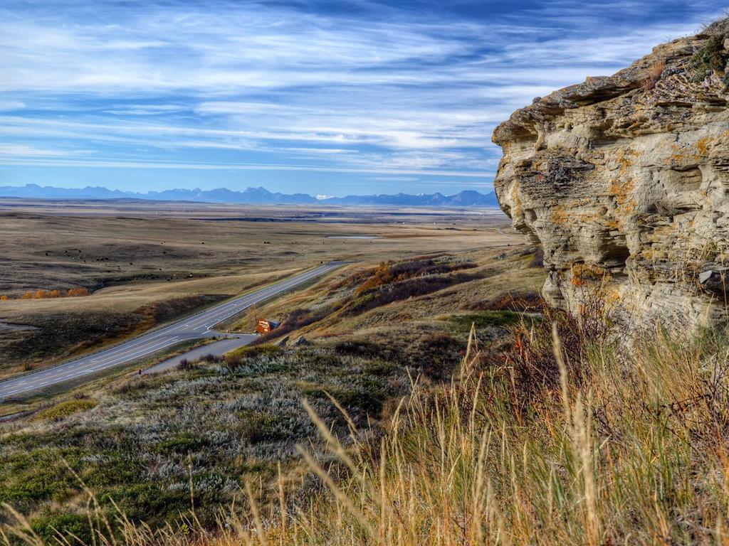
این میراث جهانی یونسکو با آن نام وحشتناکش (Head Smashed In Buffalo Jump) فقط یک پرتگاه صخره‌ای مشرف به مراتع آلبرتا است. با این حال، هم چنان که موزۀ مجاور این محل بیان می‌کند، این مکان یکی از محل‌های استراتژیک شکار برای بومیان اقوام اولیۀ کانادا (First Nations) بوده و نتیجۀ نسل‌ها نبوغ و دقت برای جمع‌آوری گاومیشان کوهان دار و رَم دادنشان از روی این صخره برای مراسم سالانۀ کشتار دسته‌ جمعی آنها بوده است. بسیار ناخوشنایند بوده ولی برای بقای این مردم سنتی ضروری محسوب می‌شده است و با چنین اهمیت فرهنگی، تاریخی و علمی در فهرست میراث جهانی یونسکو قرار گرفت.

<span>3/20</span><h2>Head Smashed In Buffalo Jump, Alberta</h2><p> This gruesomely named UNESCO World Heritage Site appears as merely a clifftop overlooking Alberta’s prairies. However, as the nearby museum celebrates, <a href="https://headsmashedin.ca/" rel="nofollow" target="_blank">this was once a strategic hunting ground </a>for First Nations people, involving generations of ingenuity and precision to herd bison over the clifftop in an annual mass slaughter. It was a gory but necessary custom with such cultural, archaeological and scientific significance it earned its UNESCO status.</p>

  • گودال سخرۀ خرس، قلمرو‌های شمال غرب

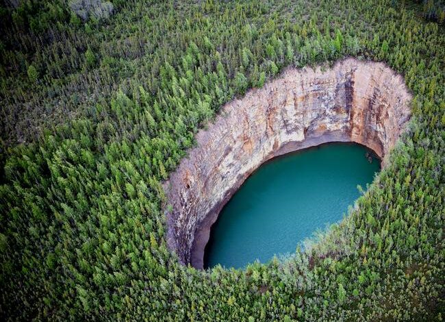
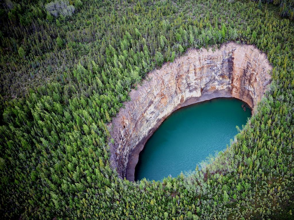
در احماق حیات وحش، تعدادی گودال عمیق در جنگل‌های انبوه قرار دارند و همانند استخرهای زمردی در میان چمن‌زار‌های سبز خود نمایی می‌کنند. خوش منظره‌ترین این گودال‌ها، گودال سخرۀ خرس (Bear Rock Sinkhole) قرار دارد که به دلیل فروپاشی غاری عظیم در زیر پوستۀ زمین بین شهر‌های تولیتا و نورمن ولز شکل گرفته است.

<span>4/20</span><h2>Bear Rock Sinkhole, Northwest Territories</h2><p> Deep in the wilds, dozens of sinkholes pit the dense forest, appearing like vibrant cerulean pools amid a blanket of green. The most photogenic of these is the bewildering <a href="https://spectacularnwt.com/" target="_blank">Bear Rock Sinkhole</a>, formed by the collapse of a vast cave under the earth’s surface, between the towns of Tulita and Norman Wells.</p>

  • جزیرۀ الزمیر، نوناووت

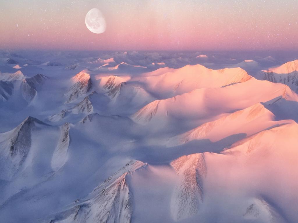
در دوردست‌ترین مناطق نوناووت، در مجاور گرینلند و مجمع‌الجزایر قطب شمال کانادا، به نظر غیر قابل باور می‌آید که جزیرۀ الزمیر 55 میلیون سال پیش یک جنگل بارانی بوده باشد. در حالی که درختان نخل و هوای گرم مدت‌های مدیدی است که رخت سفر را بسته‌اند، تنه‌های درختان باستانی در یک جنگل فسیلی باقی مانده‌اند و به دانشمندان کمک کرده‌اند تا قطب شمال پیش از عصر یخبندان را بهتر بشناسند.

<span>5/20</span><h2>Ellesmere Island, Nunavat</h2><p> In the far northern reaches of <a href="https://www.nunavuttourism.com/" target="_blank">Nunavut</a>, cosying up to Greenland in the Canadian Arctic Archipelago, it seems unfathomable that 55 million years ago, Ellesmere Island was a wetland forest. While the palm trees and warm weather have long gone, ancient tree stumps remain in an incredible fossil forest, which has helped scientists understand the Arctic before the Ice Age.</p>

  • کوهستان‌های راکی کانادا، آلبرتا و بریتیش کلمبیا

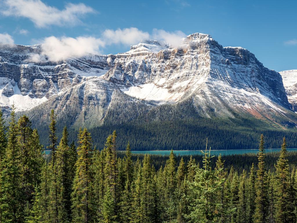
کوهستان‌های راکی کانادا با آن یخچال‌های درخشان و دریاچه های زیبا، قله‌های پوشیده از یخ، جنگل‌های انبوه و چمنزار‌های آلپی و حیات وحش گسترده آن به همان اندازۀ شیرۀ درخت افرا، تصویری کاملاً کانادایی از این کشور ارائه می‌دهد. این میراث جهانی یونسکو که در بریتیش کلمبیا و آلبرتا گسترش یافته‌ است، مجموعۀ وسیعی از شگفتی‌های طبیعی را در بر می‌گیرد.

<span>6/20</span><h2>Canadian Rockies, Alberta and BC</h2><p> Shimmering glaciers and vibrant lakes, jagged ice-capped peaks, dense forest and alpine meadows, not to mention the major wildlife roaming within — the <a href="https://au-keepexploring.canada.travel/things-to-do/canadian-rockies-alberta" target="_blank">Canadian Rockies </a>delivers a montage of landscapes as quintessentially Canadian as maple syrup. Spanning British Columbia and Alberta, this immense UNESCO World Heritage Site encompasses a vast array of natural wonders.</p>

  • مسیر کوه‌های یخی، نیوفاندلند

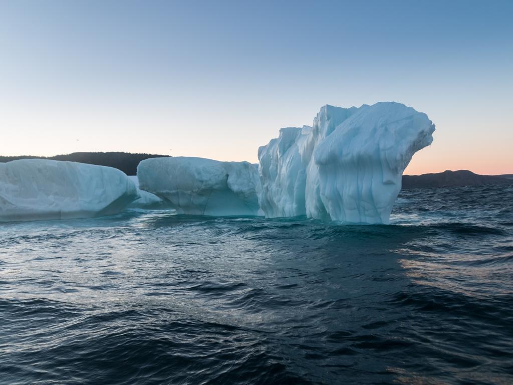
همه ساله آب در امتداد ساحل نیوفاندلند و لابرادور به یک منظرۀ دریایی چشمگیر از کوه‌های یخی عظیم بدل می‌شود که ناشی از شکستن یخچال‌های عظیم باستان در قطب شمال و شناور شدن آن در مسیر دریای آزاد است. در حالی که این مکان به جلی فوق‌العاده خطرناک برای ملوانان بدل می‌شود، برای عکاسان بسیار دیدنی به حساب می‌آید.

<span>7/20</span><h2>Iceberg Alley, Newfoundland</h2><p> Every year the stretch of water along the coast of <a href="https://www.newfoundlandlabrador.com/" target="_blank">Newfoundland and Labrador </a>is transformed into a dramatic seascape of massive icebergs, which have broken off ancient glaciers further north in the Arctic and floated down en route to the open sea. While its treacherous territory for sailors, it’s spectacular to photograph.</p>

  • صخره‌های هاپوِل، نیوبرانزویک

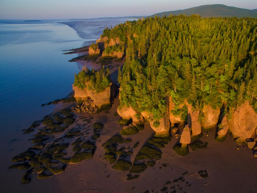
امواج  با گذر زمان به این صخره‌های شگفت‌انگیز هاپوِل (Hopewell Rocks) شکل داده است و آنها را به این اشکال عجیب درآورده است، و درختانی بر روی آنها روییده است. تعجبی نیست که به آنها صخره‌های گلدانی نیز می‌گویند. این صخره‌ها که در نقاط بالادست خلیج فاندی واقع شده‌اند، برای محدودۀ زیاد جزر و مدی آن شناخته شده است. می‌شود هنگام مد در بین این صخره‌های منحصر به فرد قدم زد.

<span>8/20</span><h2>Hopewell Rocks, New Brunswick</h2><p> Time and tide have carved the majestic <a href="https://www.tourismnewbrunswick.ca/" target="_blank">Hopewell Rocks</a> into these bizarre sandstone formations, topped with trees. No wonder they’re also known as Flowerpot Rocks. Situated on the upper reaches of the Bay of Fundy, famous for its extreme tidal range, you can walk around these unique formations at low tide.</p>

  • شفق شمالی، یوکان

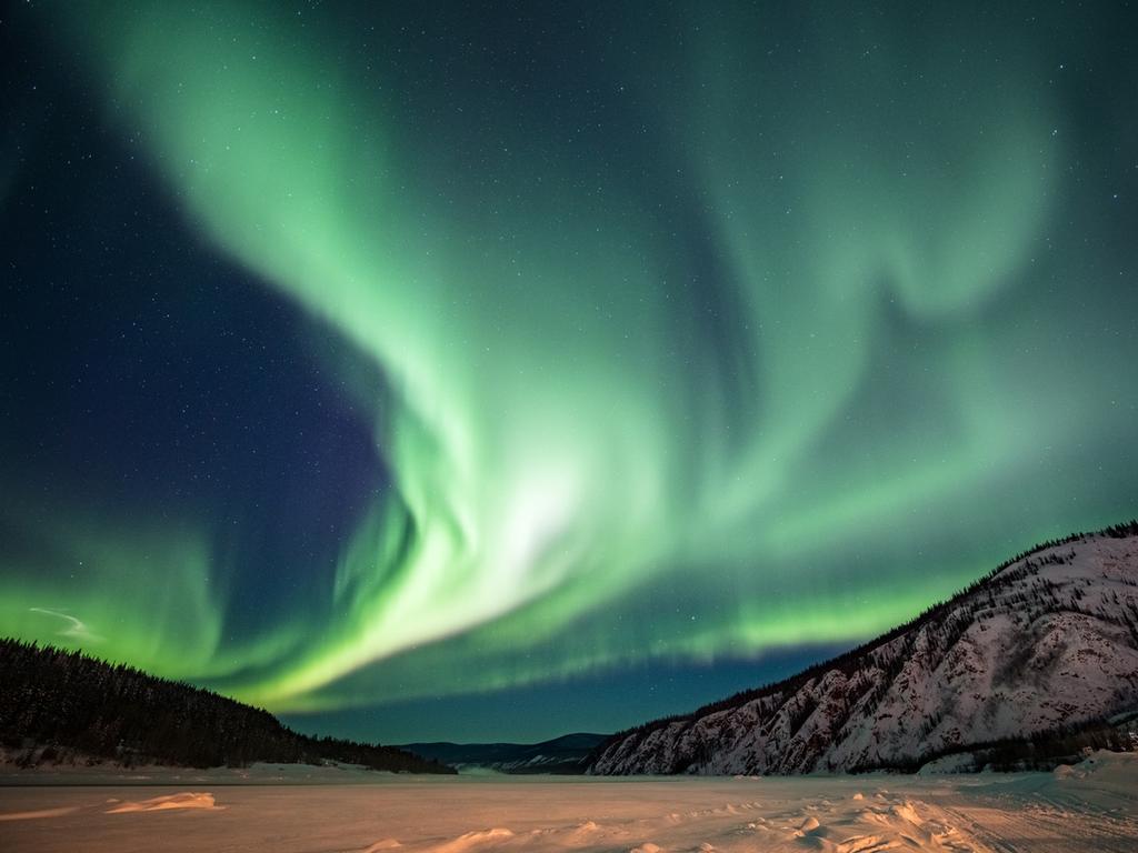
به لطف پدیده‌ای که ذرات باردار الکتریکی خورشید هنگام برخورد با گاز‌ها در اتمسفر زمین، نور‌های درخشانی تولید می‌شود و در قسمت‌هایی از کانادا می‌توان روبان‌های بنفش، سبز، آبی، و قرمز را در پهنای آسمان شب مشاهده کرد. شفق شمالی که به نورهای شمالی نیز شناخته می‌شود را می‌توان در کشورهای زیادی دید، اما مجاورت کانادا با قطب شمال و آسمان‌های تیره و بدون ابر در یوکان، نوناووت و قلمروهای شمل غرب این منظره را چند برابر زیبا می‌سازند.

<span>9/20</span><h2>Aurora Borealis, Yukon</h2><p> Thanks to a phenomenon where the sun’s electrically charged particles collide with gases in Earth’s atmosphere to create a glow, parts of Canada are often treated to a display of purple, green, blue and red ribbons streaming across the night sky. The aurora borealis (aka Northern Lights) can be seen in many countries, but Canada’s proximity to the North Pole and particularly dark, clear skies in the Yukon, Nunavut and the Northwest Territories intensify the spectacle.</p>

  • پارک ملی دریاچه‌های واترتون، آلبرتا

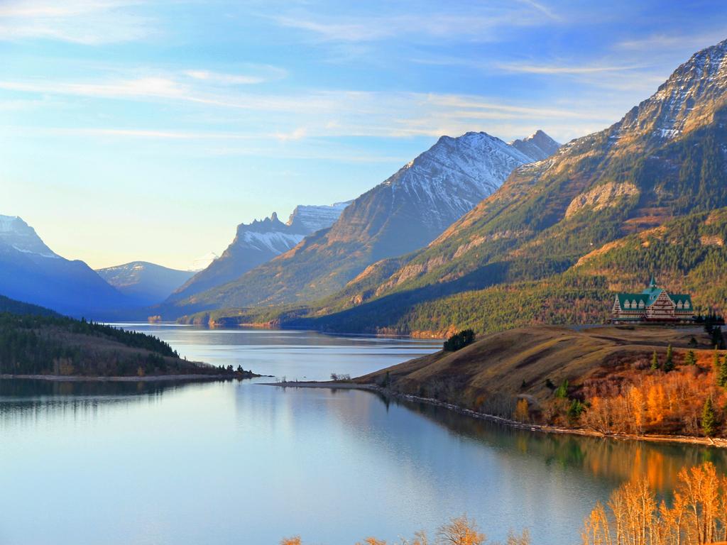
واترتون که در امتداد مرز آلبرتا و مونتانا پراکنده است به عنوان ذخیره گاه زیست کرۀ یونسکو، میراث جهانی و اولین پارک آسمان تاریک در جهان برای مشاهدۀ ستارگان شناخته شده است. در طول روز می‌توان در دریاچه‌های وسیع و سازه‌های صخره‌‌ای منحصر به فرد این پارک به جستجو پرداخت. این سازه‌های صخره‌ای از قدیمی‌ترین سنگ‌های رسوبی کوهستان‌های راکی کانادا به شمار می‌آیند.

<span>10/20</span><h2>Waterton Lakes National Park, Alberta</h2><p> Sprawling along the Alberta-Montana border, <a href="https://www.pc.gc.ca/en/pn-np/ab/waterton" target="_blank">Waterton </a>is an official Biosphere Reserve, World Heritage Site and the first multinational dark sky park in the world, committed to stargazing. During the day, explore the park’s vast lakes (including the deepest one in the Canadian Rockies), and the unique rock formations that surround, featuring some of the oldest exposed sedimentary rock in the Canadian Rockies.</p>

  • جنگل کاثیدرال، بریتیش کلمبیا

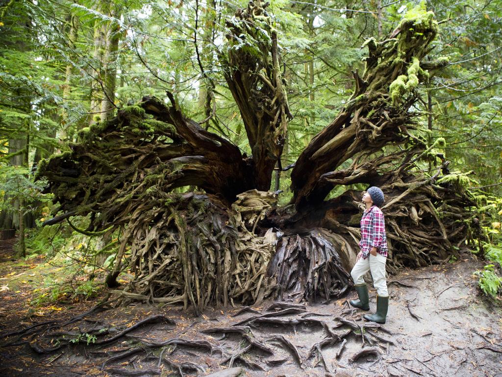
در جنگل کاثیدرال (Cathedral Grove) می‌توان باقی‌ماندۀ اکوسیستم صنوبر‌های باستانی داگلاس را در مرز‌های پارک استانی مک میلان پیدا کرد که در 175 کیلومتری شمال ویکتوریا در جزیرۀ ونکوور قرار دارد. این گنجینۀ زیستی که بعضی از درخت‌های آن با 75 متر ارتفاع و 9 متر قطر، تخمین زده می‌شود 800 سال عمر داشته باشند، هزاران سال است که وجود دارد. تنها بخشی از آن چیزیست که منظرۀ ساحل غربی بریتیش کلمبیار را قبل از آمدن ساکنین اروپایی شکل داده است.

<span>11/20</span><h2>Cathedral Grove, BC</h2><p> You’ll find this endangered remnant of an ancient Douglas fir ecosystem within MacMillan Provincial Park, 175km north of Victoria (BC’s capital city) on <a href="https://www.discovervancouverisland.com/" target="_blank">Vancouver Island</a>. This biological treasure was thousands of years in the making, with some remaining trees estimated to be 800 years old, towering 75m high and nine metres in circumference. It’s just a slice of what BC’s west coast looked like before the arrival of European settlers.</p>

  • جزیرۀ هایدا، بریتیش کلمبیا

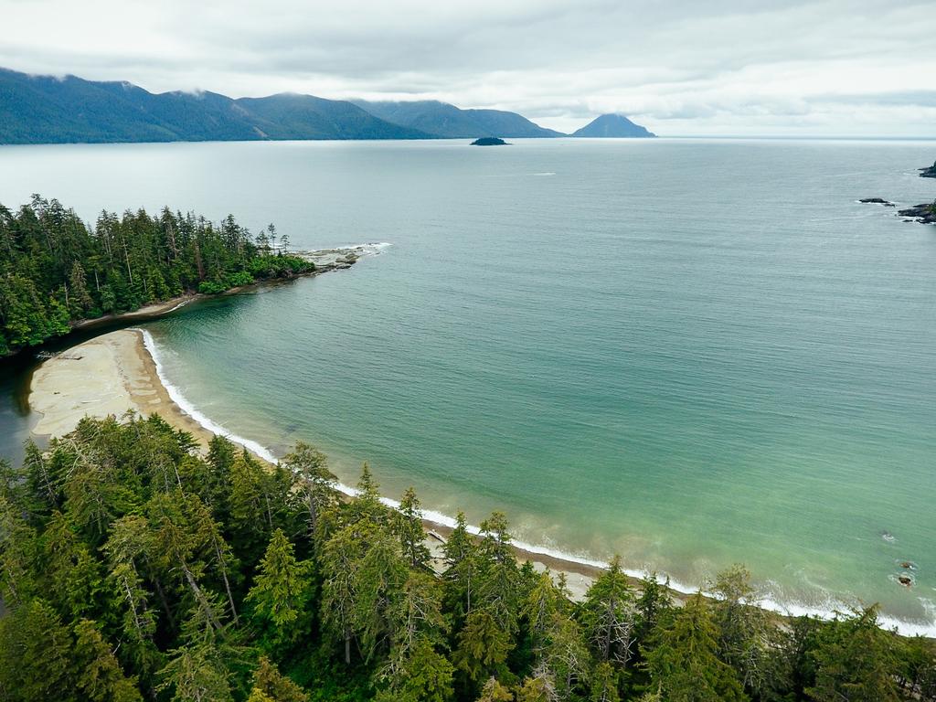
هایدا گوایی (که در زبان محلی بومیان ساکن آنجا به معنای جزایر انسان است) و یا جزایر ملکه شارلوت، مجمع‌الجزایر دورافتاده‌ای از سرزمین اصلی بریتیش کلمبیا است. از ویژگی‌‌های این منطقه می‌توان به جنگل‌های بارانی بکر، کوهستان‌های آلپاین، و ساحل‌های طولانی شنی اشاره کرد، همچنین چهل گونه و زیر گونۀ گیاهان و حیوانات در این جزایر وجود دارد. این جزایر همچنین سرزمین جوامع هایدا است که تلاش دارند فرهنگ غنی ملت‌های اولیۀ آنجا را حفظ کنند.

<span>12/20</span><h2>Haida Gwaii, British Columbia</h2><p>Also known as the Queen Charlotte Islands, the remote <a href="http://www.gohaidagwaii.ca/" target="_blank">Haida Gwaii archipelago </a>is off northern mainland BC. Characterised by pristine stretches of temperate rainforests, alpine mountains and long sandy beaches, there are 40 unique species and subspecies of plants and animals here. It’s also home to Haida communities who continue to protect the region’s rich First Nations culture.</p>

  • ذخیره‌گاه اکولوژیکی Mistaken Point، نیوفاندلند و لابرادور

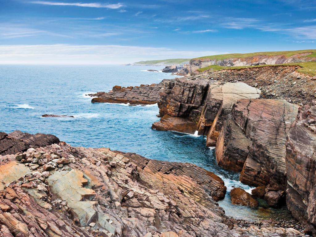
در حالی که این منطقۀ حیات وحش حفاظت شده است، تنها از طریق تور و یا با مجوز می‌توان از آن دیدن کرد، دیدن یکی از مهم‌ترین مکان‌های فسیلی جهان البته ارزش تلاش بیشتر را نیز دارد. انتظار دیدن فیسل‌های 500 میلیون مدفون در دل صفحه‌های سنگی را داشت باشید.

<span>13/20</span><h2>Mistaken Point Ecological Reserve, Newfoundland and Labrador</h2><p> While this protected wilderness area is accessible only via guided tour or permit, it’s worth the extra effort to see <a href="https://www.flr.gov.nl.ca/natural_areas/wer/r_mpe/" target="_blank">one of the world’s most significant fossil sites</a>. Expect to see 500 million-year-old fossils embedded into planes of rock within this UNESCO World Heritage Site. Picture: Wayne Barrett</p>

  • ساحل شن‌های قرمز، جزیرۀ پرنس ادوارد

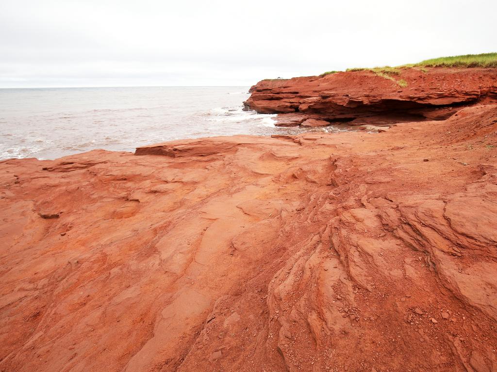
به دلیل میزان بالای آهن در خاک بخشی از خط ساحلی جزیرۀ پرنس ادوارد مزین به صخره‌های ماسه‌سنگ قرمز، جاده‌های گل سرخ، و ساحل‌های شنی به رنگ قرمز است. ساحل کاوندیش محل ملاقات مشهوری برای ساحل رو‌ها است که عادت دارند در خط ساحلی قدم بزنند و یا بر لبۀ سخره‌ها بنشینند و از منظره لذت ببرند.

<span>14/20</span><h2>Red Sands Shore, Prince Edward Island</h2><p>Thanks to high iron content in the soil, <a href="https://www.tourismpei.com/red-sands-shore" target="_blank">parts of Prince Edward Island’s coastline </a>are emblazoned with red sandstone cliffs, red clay roads and rose-tinted sand beaches. Cavendish Beach is a popular hangout for beachgoers, who can walk around the vibrant cliffs or just take in the views from the shoreline.</p>

  • دریاچۀ لکه‌ای، بریتیش کلمبیا

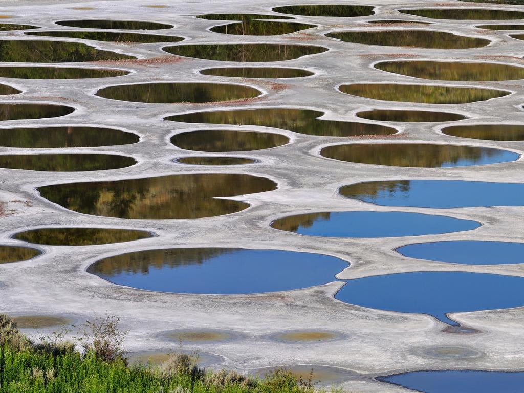
دریاچۀ لکه‌ای (Spotted lake) که در فاصلۀ 380 کیلومتری شرق ونکوور در اوسویوس، تنها منطقۀ صحرایی کانادا قرار دارد وتنها مانند یک سراب کنار جاده‌ای به نظر می‌رشد. هرچند که دلیل به وجود آمدن آنها آب سرشار از املاح معدنی است، بیشتر آب در طول ماه‌های گرم تابستان بخار می‌شود و غلظت این املاح را در این لکه‌های دریاچه‌ای بالا می‌برد. اندازه و رنگ آنها در طول ماه‌های گرم تغییر می‌کند زیرا تبخیر باعث می‌شود نسبت املاح معدنی در آنها تغییر پیدا کند.

<span>15/20</span><h2>Spotted Lake, BC</h2><p> Situated 380km east of Vancouver in Osoyoos, Canada’s only true desert environment, <a href="https://www.hellobc.com/stories/the-magic-of-spotted-lake-in-osoyoos/" target="_blank">this bizarre lake </a>seems like a roadside mirage. However, it’s the result of mineral-rich water, much of which evaporates during the hot summer months, leaving behind a concentration of these minerals that form the lake’s ‘spots’. They even shift in size and colour throughout the warmer months as the mineral ratios change with further evaporation.</p>

  • پارک استانی دایناسور، آلبرتا

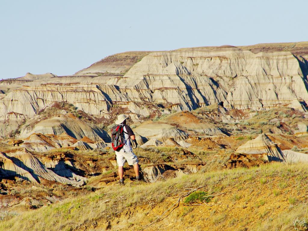
هفتاد و سه میلیون سال پیش، پارک استانی دایناسور یک بهشت استوایی پر از درختان نخل جامبو و سرخس بود، و حدس بزن پر از دایناسور. امروز در فهرست میراس جهانی یونسکو قرار دارد و با 220 کیلومتر در شرق کلگری بیش از 150 اسکلت دایناسور در آن پیدا شده است. هنوز فسیل‌های زیادی مانده تا پیدا شوند، و شما نیز می‌توانید در آن بدون مدرک دانشگاهی در دیرینه شناسی، به جستجوی فسیل بپردازید.

<span>16/20</span><h2>Dinosaur Provincial Park, Alberta</h2><p> Seventy-five million years ago, <a href="https://www.travelalberta.com/au/" rel="nofollow" target="_blank">Dinosaur Provincial Park </a>was a subtropical paradise thick with jumbo palms and ferns and, you guessed it, dinosaurs. Today it’s a designated UNESCO World Heritage Site 220km east of Calgary, where more than 150 full dinosaur skeletons have been unearthed. With more still being discovered, you can also fossick for Jurassic remains in the park, no palaeontology degree required.</p>

  • سایت ملی تاریخی غار و آبگیر، آلبرتا

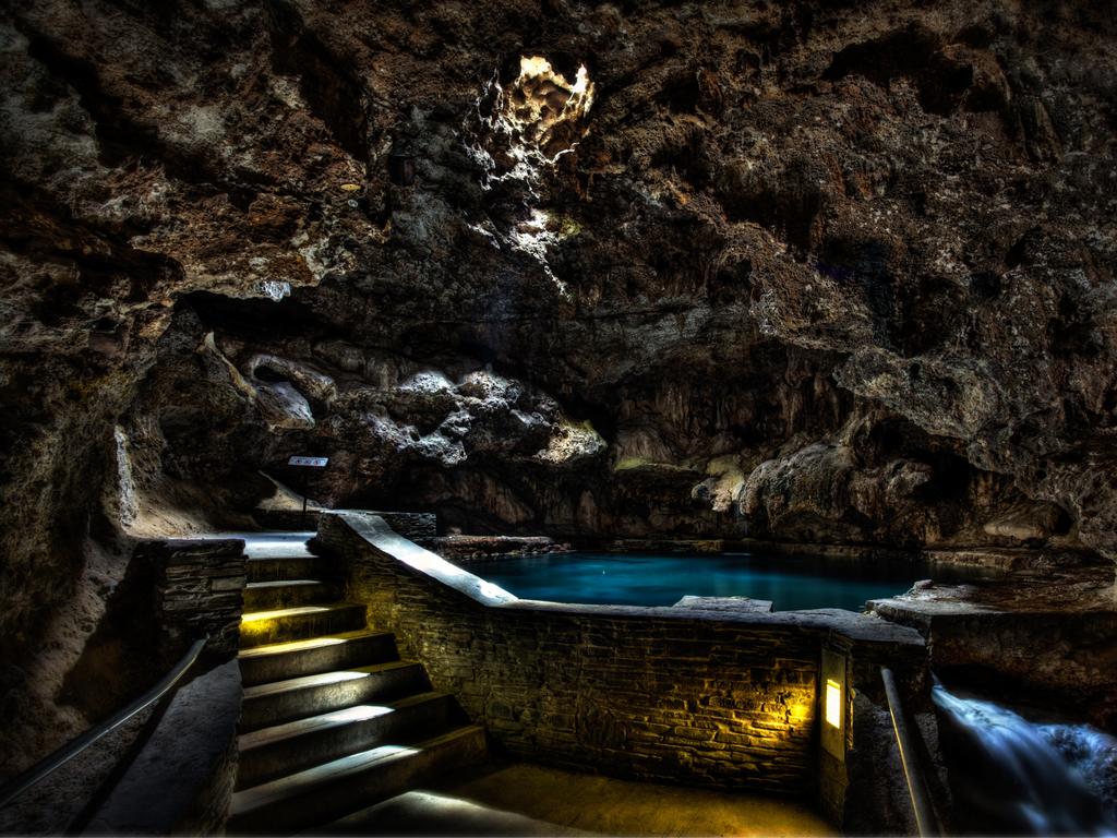
تنها آن طرف مرکز شلوغ شهر بَنف این غار پر از بخار کنار کوه سولفور است که به عنوان زادگاه پارک های ملی کانادا شناخته می‌شود. در سال 1883، کارگران راه آهن به غار و آب‌های گرم آن برخورد کردند، و بعد از آن عنوان اولین پارک ملی کانادا را به خود گرفت، و آن را به عنوان یک شگفتی طبیعی از نظر فرهنگی و تاریخی قابل توجه به همه معرفی کرد.

<span>17/20</span><h2>Cave and Basin Historic Site, Alberta</h2><p> Just beyond Banff’s bustling town centre is this steamy cavern flanking Sulphur Mountain, celebrated as the birthplace of <a href="https://www.travelalberta.com/au/" target="_blank">Canada’s national parks</a>. In 1883, railway workers stumbled across the cave and its thermal waters, which resulted in Canada’s first national park, cementing it as a culturally and historically significant natural wonder for all. Picture: Graham Twoney</p>

  • یخچال طبیعی آتاباسکا، آلبرتا

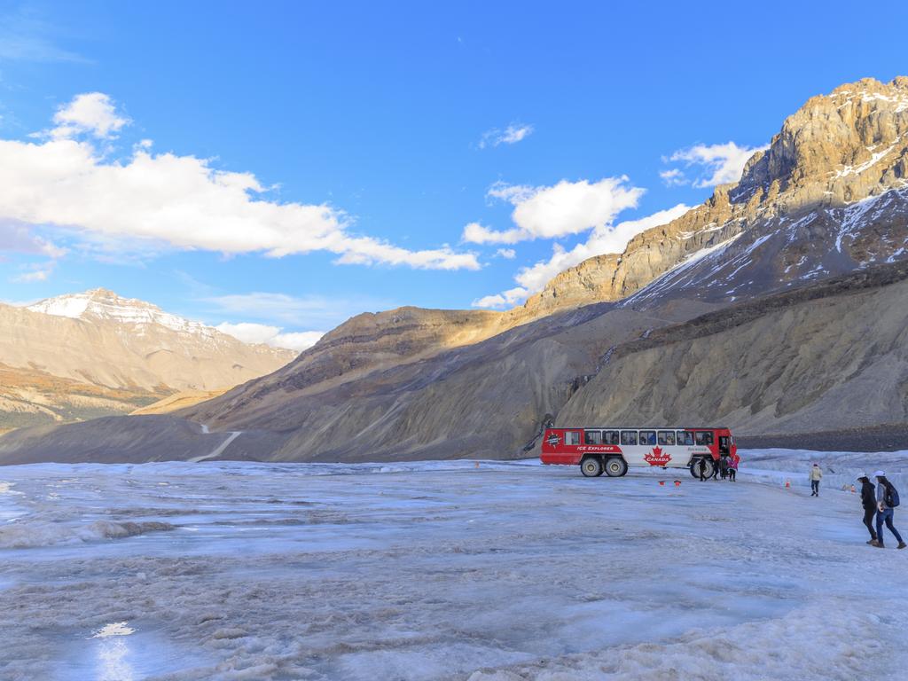
به عنوان یكی از عجایب طبیعی در امتداد میدان های یخی Parkway در کوه‌های راکی کانادا، یخچال آتاباسکا به عنوان یکی از در دسترس ترین یخچال های طبیعی شناخته شده است. زبانۀ یخچال با طول شش كیلومتر طول و تقریبا یك كیلومتر عرض، تنها نمونه‌ای کوچک از آن است.

<span>18/20</span><h2>Athabasca Glacier, Alberta</h2><p> As one of many natural wonders along the iconic Icefields Parkway in the Canadian Rockies, <a href="https://www.travelalberta.com/au/listings/athabasca-glacier-1996/" target="_blank">Athabasca Glacier </a>is a highlight as one of the most accessible glaciers in the world. Spanning six kilometres long and almost one kilometre wide, the tongue of the glacier is just a short stroll from the iconic highway.</p>

  • پارک ملی گرو  مورن، نیوفاندلند

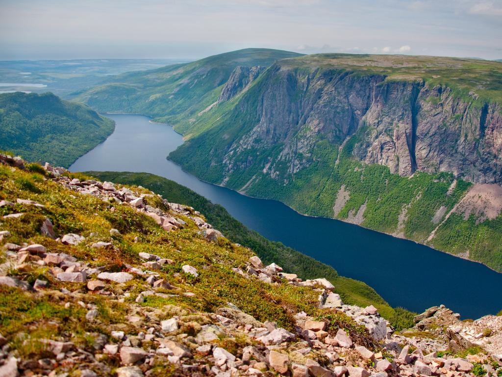
در حالی که کوهنوردان این مکان میراث جهانی یونسکو را به دلیل چشم اندازهای دیدنی‌اش، از دریاچه های بکر و کوه‌های صاف گرفته تا جنگل‌های عمیق، دوست دارند، زمین شناسان خصوصاً به سرزمین‌های مرتفع آن علاقه دارند. در اینجا می‌توان روی پوسته زمین – سنگی به رنگ برنز از اعماق پوسته زمین قدم زد. در هیچ کجای دنیا این ماده به این راحتی در دسترس نیست که به دانشمندان تا این حد در درک زمین‌شناسی سیاره ما کمک کرده باشد.

<span>19/20</span><h2>Gros Morne National Park, Newfoundland</h2><p> While hikers love this <a href="https://www.newfoundlandlabrador.com/top-destinations/gros-morne" target="_blank">UNESCO World Heritage Site</a> for its spectacular scenery, from pristine lakes and flat-topped mountains to deep forests, geologists are particularly enamoured by its tablelands. Here you walk on the earth’s mantle — bronze-coloured rock from deep within the earth’s crust. Nowhere is this material so accessible, which has helped scientists understand the geology of our planet.</p>

  • پارک ملی وود بافالو، آلبرتا

پارک ملی وود بوفالو (Wood Buffalo) به عنوان بزرگترین پارک ملی کانادا، همه‌اش به به مقیاس‌های عظیم الجسه مرتبط است. این مکان بزرگترین پستاندار خشکی بومی آمریکای شمالی (گاومیش کوهان دار)، بزرگترین پرنده قاره (درنای جارچی)، یکی از بزرگترین اکوسیستم های دلتای آب شیرین و اکنون این میراث جهانی یونسکو ادعا می کند که دارای بزرگترین سد سگ آبی جهان است.

<span>20/20</span><h2>Wood Buffalo National Park, Alberta</h2><p> As the largest national park in Canada, <a href="https://www.pc.gc.ca/en" target="_blank">Wood Buffalo National Park </a>is all about jumbo-sized accomplishments. It’s home to the largest land mammal native to North America (wood bison), the continent’s largest bird (whooping crane), one of the largest freshwater delta ecosystems, and now this UNESCO World Heritage Site claims to have the world’s largest beaver dam.<br/></p>

مشاهده بیشتر

نوشته های مشابه

دیدگاهتان را بنویسید

نشانی ایمیل شما منتشر نخواهد شد. بخش‌های موردنیاز علامت‌گذاری شده‌اند *

دکمه بازگشت به بالا